Breakfast was ohmygoodnesssooooo good! Biscuits, gravy, shrimp, grits, French toast, two egg dishes, fruit, yogurt, sticky buns, bacon wrapped asparagus, potatoes, honey ham, oj and tea/coffee. Right!!?! It was amazing, and we all woke up early to feast. I think it was better than the blueberry patch!

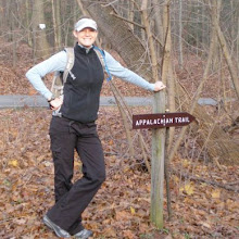
We hung around inside the B&B and watched the weather report before packing up our slightly wet tents (it got cold and wet last night by the stream, so there was a bit of condensation...), and then we were off! At ten. (and we began breakfast at 7:30...!?) Robert/Iron Horse was raring to go (see photo).
But off we were. Backwards stayed with us and we began what was going to ge a long, but fairly easy day. Nice cool weather and a good pace, but about a mile or two in, I was leading, and we got to a hill. There were two other hikers who stopped to let us pass. Morning! We got to the top and didn't see a blaze. There was, however, an arrow in the dirt that said "AT -->." We followed and eventually found the trail going off to the right. We followed it down in what seemed like a circle and came out at a hill that looked just like the one we'd gone up a bit ago. We weren't convinced, so we continued on until we realized that we'd gotten turned around. Robert/Iron Horse was threatening to just keep going back to the hostel, but we had to figure this out. I hiked back up to a sign I saw with N and S on it and realized that we were indeed hiking the wrong way! Aparently, those two hikers who had stopped to let us pass were blocking the blaze sign that told us to take a sharp right in the middle of the hill! What are the chances...? Ugh. So we went back up the correct way and finally got to where the trail was supposed to go. Though I felt bad that I had been leading, I think it was just one of those things... bound to happen.

Back to walking. We passed a turn-off to a waterfall and three of us checked it out while Robert/Iron Horse walked on ahead. Lovely and high falls and a lovely couple from Florida/Colorado. Since they were going south, they gave us distance tips, extra bars, and perscription ointment (she was a nurse) for my poison ivy. (yep - I managed to get some on my left foot, with flecks on my legs and one arm... boo me, but yay ointment!!)

Kept walking till we caught up with Robert/Iron Horse. Snacked at a shelter. Kept moving. Played a few games while walking. Powder and Russell joined in. And we eventually made it to the shelter! Biggest day yet with Adam and Robert/Iron Horse. 18.2 miles. (plus maybe .8 miles of doubleback...) Oh, and in the way, I passed the FOUR HUNDRED MILE marker -a stream (see photo).
The group that calls themselves "chicken pot pie" was there (Tiny Dancer, Salty, Mister T, Hot Sauce) and we set up our tents since they were in the small shelter. There was a chance of rain, but there always is... Nice big fire. Good chatter. Mac n cheese with bacon bits. The DC guys brought dehydrated ice cream and we all shared it. Bed.
Pretty tired. But only 6 miles to the Kincora hostel in the morning!
(18.2)
-- Posted from the trail...
Location:Mooreland Gap Shelter

No comments:
Post a Comment